GRASS 4.2.1 (V.18, V.19, ...) and GRASS 5 offer two ways to import data from the GTOPO30 worldwide elevation datacase (and GLCC maps / GLCC info).
1. So, get the data for your region.
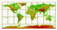
2. Look at the .GIF file, if you like.
3. Check the .PRJ file for the projection. We need this info for creating the GRASS location later.
4. Find out the boundaries for your area (East and North positive):
          Latitude (row)     Longitude (col)               Elevation
 Tile    Minimum  Maximum   Minimum  Maximum   Minimum  Maximum  Mean  Std.Dev.
-------  ----------------   ----------------   --------------------------------

W180N90     40       90       -180    -140         1      6098    448     482
W140N90     40       90       -140    -100         1      4635    730     596
W100N90     40       90       -100     -60         1      2416    333     280
W060N90     40       90        -60     -20         1      3940   1624     933
W020N90     40       90        -20      20       -30      4536    399     425
E020N90     40       90         20      60      -137      5483    213     312
E060N90     40       90         60     100      -152      7169    509     698
E100N90     40       90        100     140         1      3877    597     455
E140N90     40       90        140     180         1      4588    414     401
W180N40    -10       40       -180    -140         1      4148    827     862
W140N40    -10       40       -140    -100       -79      4328   1321     744
W100N40    -10       40       -100     -60         1      6710    375     610
W060N40    -10       40        -60     -20         1      2843    212     168
W020N40    -10       40        -20      20      -103      4059    445     298
E020N40    -10       40         20      60      -407      5825    727     561
E060N40    -10       40         60     100         1      8752   1804    1892
E100N40    -10       40        100     140       -40      7213    692     910
E140N40    -10       40        140     180         1      4628    549     715
W180S10    -60      -10       -180    -140         1      2732    188     297
W140S10    -60      -10       -140    -100         1       910     65     124
W100S10    -60      -10       -100     -60         1      6795   1076    1356
W060S10    -60      -10        -60     -20         1      2863    412     292
W020S10    -60      -10        -20      20         1      2590   1085     403
E020S10    -60      -10         20      60         1      3484    893     450
E060S10    -60      -10         60     100         1      2687    246     303
E100S10    -60      -10        100     140         1      1499    313     182
E140S10    -60      -10        140     180         1      3405    282     252
W180S60    -90      -60       -180    -120         1      4009   1616    1043
W120S60    -90      -60       -120     -60         1      4743   1616     774
W060S60    -90      -60        -60       0         1      2916   1866     732
W000S60    -90      -60          0      60         1      3839   2867     689
E060S60    -90      -60         60     120         1      4039   2951     781
E120S60    -90      -60        120     180         1      4363   2450     665
ANTARCPS   -90      -60       -180     180         1      4748   2198    1016
  (this table was taken from GTOPO30 readme)
5. Start GRASS and create a new location
6. Accept, if valid and specify the ellipsoid ("spheroid" in .PRJ file: wgs84).
7. Accept creating the mapset. Now you have entered GRASS.
8. Proceed with data importing like described below:
-------------------------------------------------------------------------
a) use the standard module "r.in.ll" to import in a lat/long region
-------------------------------------------------------------------------

Ex:

r.in.ll -s input=E020N90.DEM output=gtopo30 bpc=2
corner=sw,40:00:15N,20:00:15E dimension=6000,4800 res=30,30
spheroid=wgs84

-------------------------------------------------------------------------
b) use "r.in.bin", a new module in GRASS 4.2.1/5.0, which is similar to
   r.in.ascii, to import in any region (here: lat/long).
-------------------------------------------------------------------------

Ex:

r.in.bin -bs input=E020N90.DEM output=gtopo30 bytes=2 north=90 south=40
east=60 west=20 r=6000 c=4800

(you can add "anull=-9999" if you want sea level to have No data value)
9. Look at the data or calculate something...