User are provided with a (small) variety of choices for user interface.
They can work on command line (CLI), use the built-in GIS Manager,
launch QGIS with GRASS (requires QGIS installation) and/or use
JAVAGRASS. See below for details.
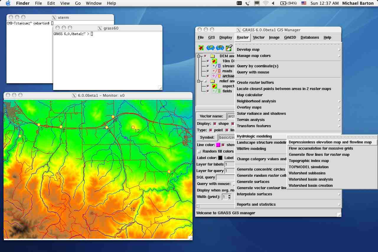
GRASS GIS Manager
This manager is integrated with GRASS 6.
GIS Manager GUI interface (click to enlarge; see more)
GRASS with Quantum GIS interface (QGIS)
Quantum GIS (QGIS) is a Geographic Information System (GIS) built for Linux/Unix.
QGIS supports vector, raster, and database formats. It optionally comes with
GRASS raster/vector support.
QGIS, launched within GRASS (click to enlarge):


GRASS shell in QGIS (click to enlarge)
QGIS Project
JAVAGRASS
JAVAGRASS (JGRASS) is a multi-platform, multi-session GRASS framework.
JGRASS packages GRASS to be used in production environments as opposed to a research environment.
The architecture of JGRASS follows the client-server model internally, separating the
Graphical User Interface (GUI) from the spatial processing engine. This separation will
allow the easy development of remote access capability.
JAVAGRASS session:

Click to enlarge
JAVAGRASS Project (Image Gallery for JGrass)
Last change: $Date$
$Author$