GRASS GIS (Geographic Resources Analysis Support System) is a
Geographical Information System (GIS) with raster, topological vector,
image processing, and graphics production functionality. If you like
to get a general idea about GRASS, please read this short description.
GRASS is released under GNU General Public License (GPL). If you are
not sure about the differences between public domain software, Free
Software and proprietary products, have a look at this
graph describing
Categories of Free and Non-Free Software. Eventually you also
want to read: Why
Open Source Software / Free Software (OSS/FS)?. This article from
David A. Wheeler tells you why.
The GRASS Wiki
- The GRASS community maintains a
Wiki collaborative help
site which contains getting started guides, tutorials, tips and tricks, FAQs,
and a lot more. See the Getting Started and First Day Documentation sections of the
main help page. The
information on the wiki will generally be more up to date than the information
found on the web pages, as migration, consolidation, and updates are a continual work
in progress.
- Visit the Getting
started section of the GRASS wiki.
Some new users questions
Under which platforms can you work with GRASS
GRASS is developed in a UNIX environment and is ported to many other systems
like:
- UNIX environment through a graphical user interface and shell in X-Windows
- MS-Windows (NT/2000/XP with Cygwin)
for the experimental winGRASS port
- MacOS X
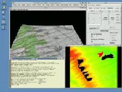
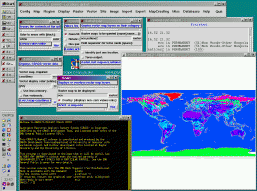
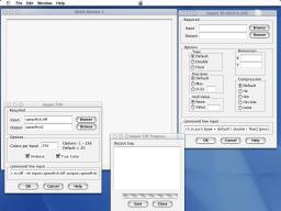
Here are some example screenshots on GRASS 5 (old) running under Linux,
Windows/Cygwin and MacOS X.
What can I do with GRASS? - Some examples
- See our growing Applications and Screenshots page.
Here you will find many examples on Applications and Institutes using GRASS, including an image gallery and reports.
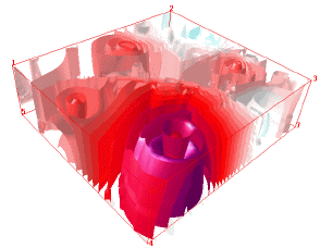
- Check out the new 3D
raster volume format. It comes along with a 3D raster map algebra module,
3D volume interpolation, and other features. You can also export the GRASS 3D
data to Vis5D visualization tool.
- Maybe you are interested in one of the many GRASS GIS related
projects and libraries, such as MapServer, GDAL, PostgreSQL, OGR, libgrass, PROJ4 etc..
- Or have a look at the NVIZ 3-D GRASS Interface.
- Get information about the GRASS 6 development.
- There also exist many external packages for GRASS called Add-ons.
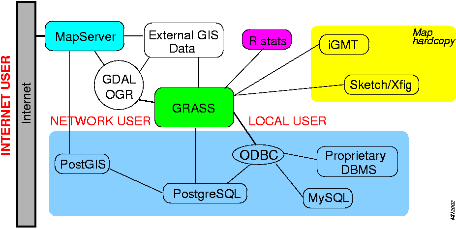
- GRASS as a modular based GIS offers a wide range of possibilites to build professional
solutions. The figure below is an example how grass can be used with other
applications

Does GRASS support SQL databases?
GRASS can be used for vast amounts of useful work without needing an
external database installed at all. Specifically if you have
data with multiple attributes (e.g. in a DBF file exported from other GIS or
database software) and wish to manipulate the data using
queries on these multiple attributes, you may find it useful to use an
external database. In GRASS 5.0/5.3
there are drivers for ODBC and PostgreSQL (see the related GRASS/SQL page).
In GRASS 6 it becomes really exciting and
also includes native support for DBF files. But
this system is not yet fully implemented.
What do I need to run GRASS GIS?
You either need a standard PC or a workstation running a UNIX-like operating system with X-Windows
(Openwin, KDE, GNOME, fvwm2, ...), e.g.: Linux (Intel or PowerPC), Solaris (SPARC or Intel),
HP-UX (HP PA-RISC), FreeBSD (Intel, Alpha AXP), Mac OS X (PowerPC), or another UNIX-compliant
system or MS-Windows (NT/2000/XP with cygwin) for the experimental native winGRASS port.
NOTE: You can also install Linux or another operating system in its own hard drive partition
and run a Windows system parallel in another hard drive partition.
- GRASS binaries need around 50-80MB space
- GRASS sources need around 100MB+.
Looking for the GRASS software to download?
- Please proceed to our download page.
Here you find all information on Binaries, Sources, CVS access,
installing, compiling, etc.
Well, I can't get my GIS data into GRASS! What now?
The GRASS Documentation Project
The documentation in GRASS is managed within the GRASS Documentation Project
(GDP). The idea is to collect all the online documentation available for GRASS
in one space. The GDP is devided into 6 sections:
- General/Features (descriptions on GRASS modules, FAQs, related articles etc.)
and Manual pages (GRASS commands and manual pages)
- Books, Tutorials (Tutorials in english, italian, german etc.)
and GRASS Courses in english, german, japanese)
- Install/Prog (Documentation on Installing and Programming GRASS)
- Special Topics (DBMS, modeling, analysis etc.)
If you have additional documents for the GDP, please send a mail to
GRASS web page team.
What are LOCATIONs and MAPSETs?
A LOCATION is some geographic extent of interest that contains data sets
that [should] all be in the same coordinate system. Every location has a
PERMANENT directory which stores some basic information about the whole
location, and is a good place to park base files. You can think of a
location as a data library for a region of interest.
In a MAPSET you can organize GIS maps thematically or geographically or by
project or whatever. Every GRASS session runs under the name of a MAPSET. A
MAPSET may be a geographical subset or as large as the parent LOCATION.
Technically they are subdirectories under any location. In a networked
environment with several users working within the same location, mapsets
play a special role. Users may only select (and thus modify) a mapset that
they own (i.e., have created). However, data in all mapsets for a given
location can be read by anyone (unless prevented by UNIX file permissions).
The "PERMANENT" mapset usually contains the read-only base maps like the
elevation model, while the other locations are readable and writable by
their owners. The "PERMANENT" mapset also contains some information about
the location itself that is not found in other mapsets (projection info
etc.), thus it must exist in every location.
Putting LOCATIONs on a central server, a team can work inside this project
database (usually NFS is used).
Looking for GRASS tutorials or sample data?
- There is an online Books and Tutorials Collection available
inside the GRASS Documentation Project (GDP). Here
you find links to existing GRASS Tutorials in english and several
foreign languages (german, italian, korean and polish).
- We also provide further sample datasets
including data which are already in GRASS format and ready to use and links to external GIS data
(raster, vector etc.).
I know GIS already and want to program within the GRASS environment
- As GRASS is an open source GIS, so you have full access. We suggest that you get a fresh copy from
the GRASS CVS repository.
Consider to subscribe to the GRASS Developers mailing list.
The GRASS Programmer's Manual is available here.
- If you would like to take part in the GRASS Development. See also the
Get Involved! page.
I downloaded GRASS - but what now?
- GRASS is running in a session.
The data are stored in a so-called "location" which is effectively a collection
of subdirectories. When running GRASS, you have to define or load such
a location which contains the data as well as projection definitions.
- To start with own data, create
an emtpy directory within your home directory. For example, call it "grassdata".
This directory is where GRASS will create and store its database.
- To warm up, we strongly recommend to start with sample datasets!.
A good idea is to download the Spearfish data containing raster, vector and
point data of South Dakota. There is also described how to start GRASS with the SPEARFISH
dataset.
- After extraction of the sample
data set in the "grassdata" directory, start GRASS:
grass5 or grass43
in your terminal.
- Enter a name for the project area ("location") and subarea ("mapset"). The mapset extent can be the
same as the location extent (the best is to enter your own name here).
Enter the path to your "grassdata" directory. Example (see startup screen):
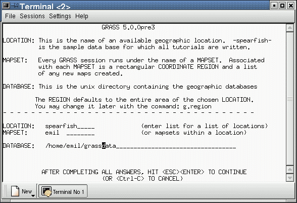
- In this example GRASS would be started in the spearfish location under the mapset emil.
You can now start working (open a X-window with d.mon start=x0, visualise a
raster map with d.rast etc.), but at this point you should refer to one of the GRASS
Tutorials or other help available on the GRASS pages.
Enjoy the world's largest open source GIS!
See additionally further Online Courses for further help and
the online manual pages.
Last change: $Date$
$Author$