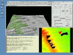

| GRASS Applications and Screenshots |


On this page you find worldwide demonstrations of the power of GRASS GIS. Here known GRASS projects are linked. If you have input for this page, please email us.
 GRASS online with GRASSLinks 3.1 [english]
(at REGIS at Univerity of California, Berkeley). GRASSLinks offers WWW-access to spatial databases.
 Japanese geological Info-Server: GRASS online with GRASSLinks [japanese/english]
(at Osaka City University, Japan). - 2nd server
 Grules: JAVA-GRASS Server
(Federico Ponchio, Italy)
 GRASS linked to MapServer
Hydrological Applications:
 USDA-ARS SWAT/GRASS interface connects the Soil and Water Assessment Tool to GRASS
 A great set of visualizations and demos can be found at William Hargrove's website,
including the Clinch River Restoration Project. Lots of mpegs and animations.
 NVIZ 3D tool:


 Multidimensional
spatial interpolation at GMS Laboratory, University of Illinois at
Urbana-Champaign - The best visualizations around!
 GRASS Visualization demos
from UIUC Viz Group - visit also
the NVIZ and
SG3d pages
 GRASS Report about Dynamic
Cartography in simulations of landscape processes from L. Mitas, B. Brown and H. Mitasova
 GRASS sample images from Thailand from HPCC/NECTEC
  TclTK based graphical user interface.
 Geomorphological Analysis of DEM (r.param.scale)
 Basin streams calculation (r.watershed)
 Stream calculation from DEM (r.watershed)
 Least cost routing (r.cost, r.drain: Alps traverse example)
 Setting ground control points for satellite image registering (i.points)
 VRML output of SPEARFISH dataset: geological map draped over DEM
(r.vrml) - big version (shaded elevation
map with 150m resolution)
 3D keyframe animation made by SG3d GRASS module (520kb MPEGfile).