NVIZ 3-D GRASS Interface

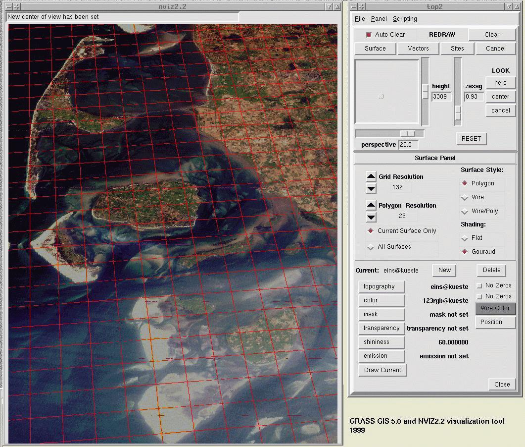
NVIZ is a GRASS module which allows users to realistically render multiple surfaces in a 3D space, optionally using thematic coloring, draping GRASS vector files over the surfaces, and displaying GRASS site files either draped on the surfaces or as 3D point locations. The NVIZ code is part of the standard GRASS source code (src.contrib/GMSL/NVIZ2.2/).

Related links:


Examples done with NVIZ 3D tool

Northern Germany: hill from miningresiduals/selected buildings with vectorized toposheet     Northern Germany: hill from miningresiduals/selected buildings with aerial image    Alps/Europe: LANDSAT-TM draped over GTOPO30DEM     Alps (Karwendel region): LANDSAT-TM draped over GTOPO30DEM     3D sites volume in soil     Parts of Europe (GLOBE DEM 1km)

© 1999-2006 GRASS Development Team
Comments about this page | FAQ | Download | Support | Docs | Programming | Back HOME
Last change: $Date$