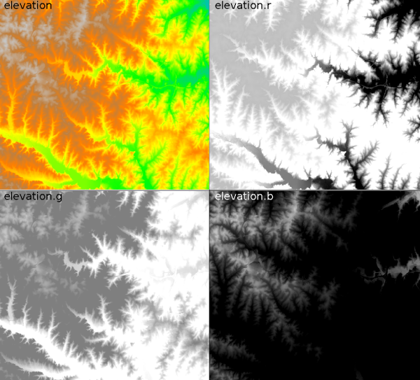
g.region raster=elevation -p
r.rgb input=elevation red=elevation.r green=elevation.g blue=elevation.b
In this case r.rgb produces in the current mapset three new raster maps - 'elevation.r', 'elevation.g', 'elevation.b'.
Last changed: $Date$