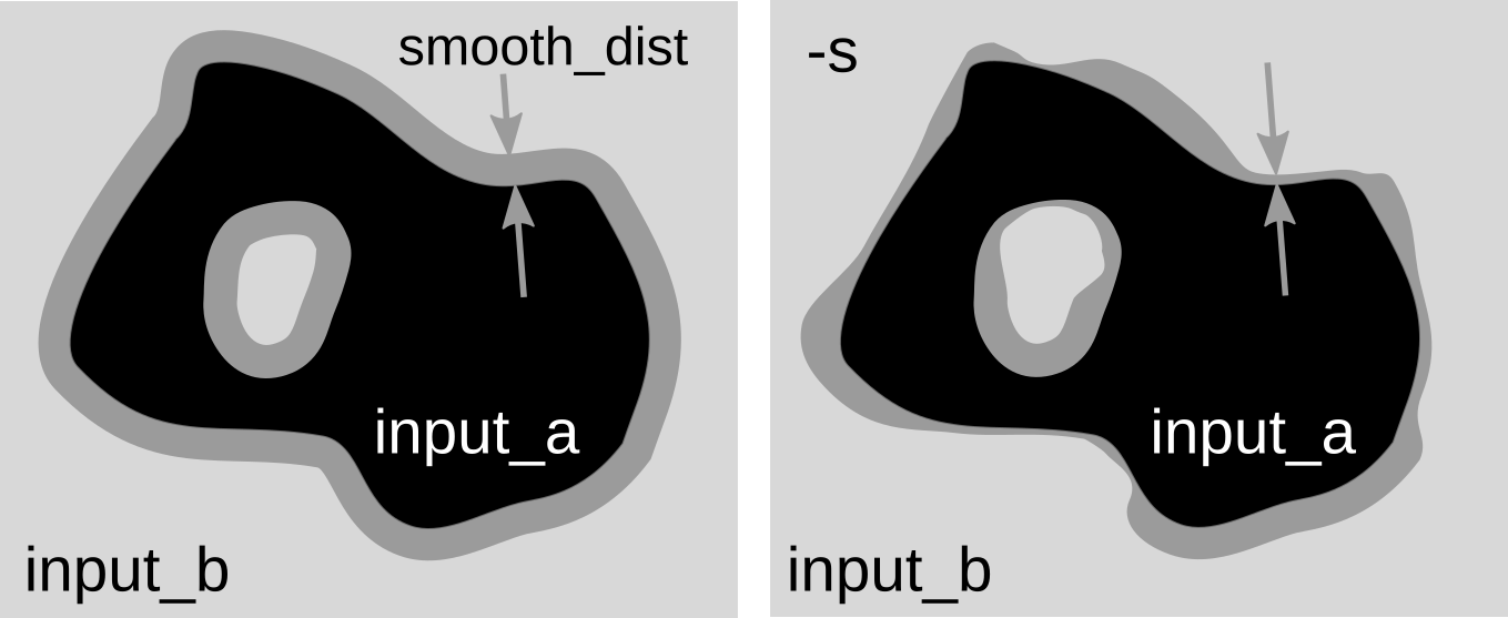
Difference between fixed overlap width and spatially variable overlap.
r.patch.smooth can be used, for example, for updating older, lower resolution DEM (input_b) with newer, higher resolution DEM (input_a). Note that both DEMs must be aligned and have the same resolution. Smoothing uses weighted averaging on the overlap of the rasters. r.patch.smooth supports 2 types of smoothing. The default one is simpler and uses fixed overlap width defined in smooth_dist. Since the differences along the seam line can vary, the second option uses spatially variable overlap width and can be activated with flag -s. The width is then computed based on the elevation differences along the edge and transition angle transition_angle controlling the steepness of the transition. If option overlap is specified, a map representing the spatially variable overlap is created and can be used for inspecting the fusion results.
For spatially variable overlap, options parallel_smoothing and difference_reach can be specified. Option parallel_smoothing smoothes the overlap zone in direction parallel to the edge. Option difference_reach enables to increase the sensitivity to higher differences on the edges by taking maximum difference values in the cells close to edges.
Option blend_mask (experimental) can be used to specify which edges of the input_a DEM should be excluded from the blending. This is useful when DEMs A and B have identical edges (on the coast, for example) and we want to preserve only A (not blend it with B along the coast). The blend_mask raster can be created by digitizing area approximately around the excluded edges, so that the edge of DEM A is inside the areas and the rest are NULLs. This option requires more testing.
Last changed: $Date$