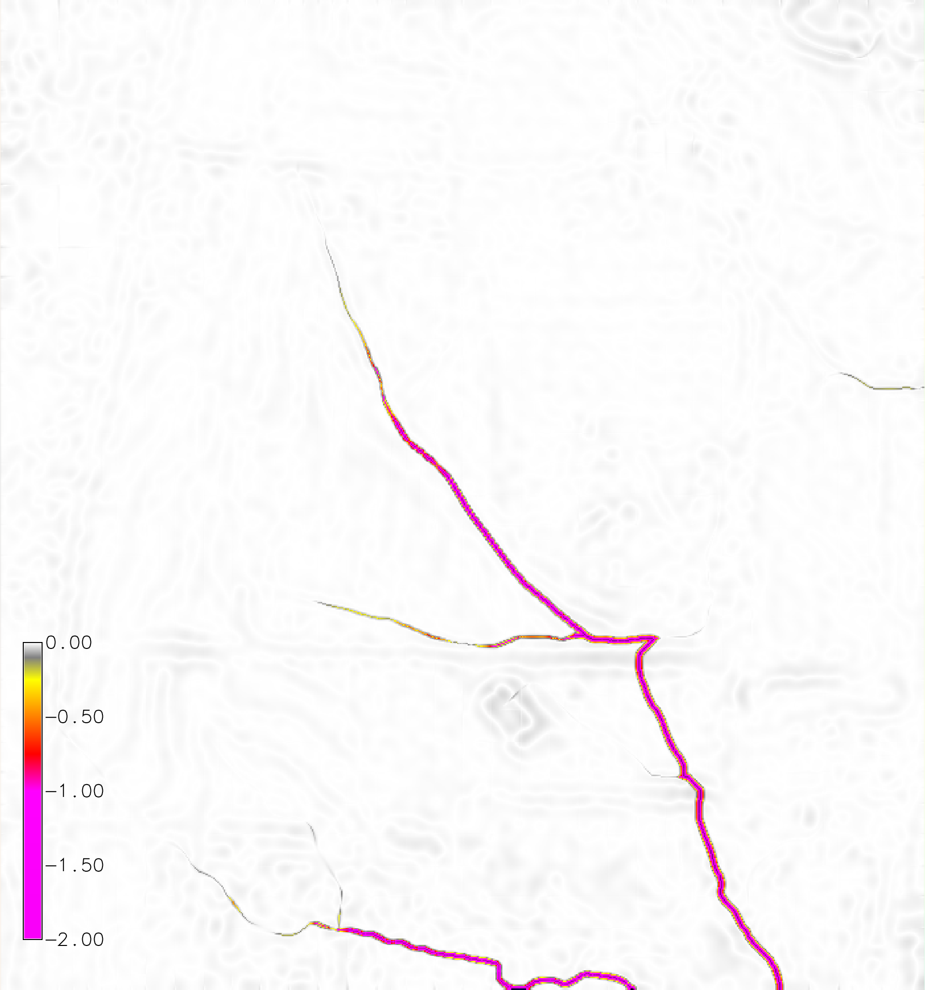
Figure: Net difference (m) for a dynamic RUSLE simulation of a 120 min event with a rainfall intensity of 50 mm/hr with a 3 minute interval.
r.sim.terrain is a short-term landscape evolution model that simulates topographic change for both steady state and dynamic flow regimes across a range of spatial scales. It uses empirical models (RUSLE3D & USPED) for soil erosion at watershed to regional scales and a physics-based model (SIMWE) for shallow overland water flow and soil erosion at subwatershed scales to compute short-term topographic change. This either steady state or dynamic model simulates how overland sediment mass flows reshape topography for a range of hydrologic soil erosion regimes based on topographic, land cover, soil, and rainfall parameters.
Basic instructions
A basic example for the North Carolina sample dataset. Install the add-on module r.sim.terrain. Copy the raster elevation map elev_lid792_1m from the PERMANENT mapset to the current mapset. Set the region to this elevation map at 1 meter resolution. Run r.sim.terrain with the RUSLE model for a 120 min event with a rainfall intensity of 50 mm/hr at a 3 minute interval. Set the empirical coefficients m and n to 0.4 and 1.3 respectively. Use the `-f` flag to fill depressions in order to reduce the effect of positive feedback loops.g.extension extension=r.sim.terrain g.copy raster=elev_lid792_1m@PERMANENT,elevation g.region raster=elev_lid792_1m res=1 r.sim.terrain -f elevation=elevation runs=event mode=rusle_mode rain_intensity=50.0 rain_duration=120 rain_interval=3 m=0.4 n=1.3
Spatially variable soil and landcover
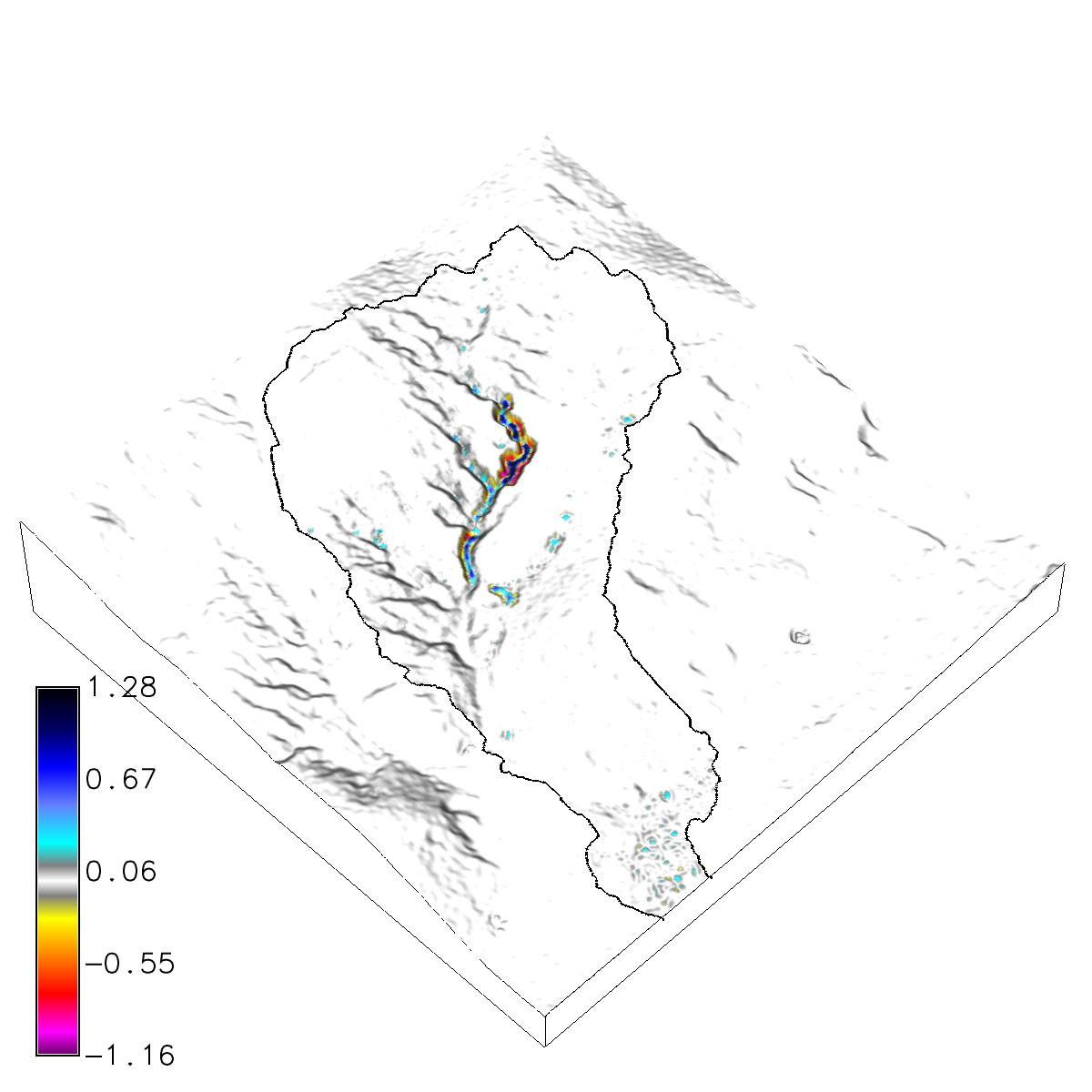
Clone or download the landscape evolution sample dataset with a time series of lidar-based digital elevation models and orthoimagery for a highly eroded subwatershed of Patterson Branch Creek, Fort Bragg, NC, USA.
Run r.sim.terrain with the simwe model for a 120 min event with a rainfall intensity of 50 mm/hr. Use a transport value lower than the detachment value to trigger a transport limited erosion regime. Use the -f flag to fill depressions in order to reduce the effect of positive feedback loops.
g.mapset -c mapset=transport location=nc_spm_evolution
g.region region=region res=1
r.mask vector=watershed
g.copy raster=elevation_2016@PERMANENT,elevation_2016
r.sim.terrain -f elevation=elevation_2016 runs=event mode=simwe_mode \
rain_intensity=50.0 rain_interval=120 rain_duration=10 walkers=1000000 \
detachment_value=0.01 transport_value=0.0001 manning=mannings runoff=runoff
ERROR: nwalk (7000001) > maxw (7000000)!
Brendan A. Harmon
Louisiana State University
brendan.harmon@gmail.com
Last changed: $Date$