Module r.skyview computes Sky-View Factor, a relief visualization technique.
The value of each cell is given by the portion of visible sky (from that cell)
limited by the surrounding relief.
The values range from 0 to 1. The lighter the value is, the more open the terrain is.
NOTES
Module r.horizon is used to compute elevation angles.
When computing these elevation angles, only the celestial hemisphere is considered.
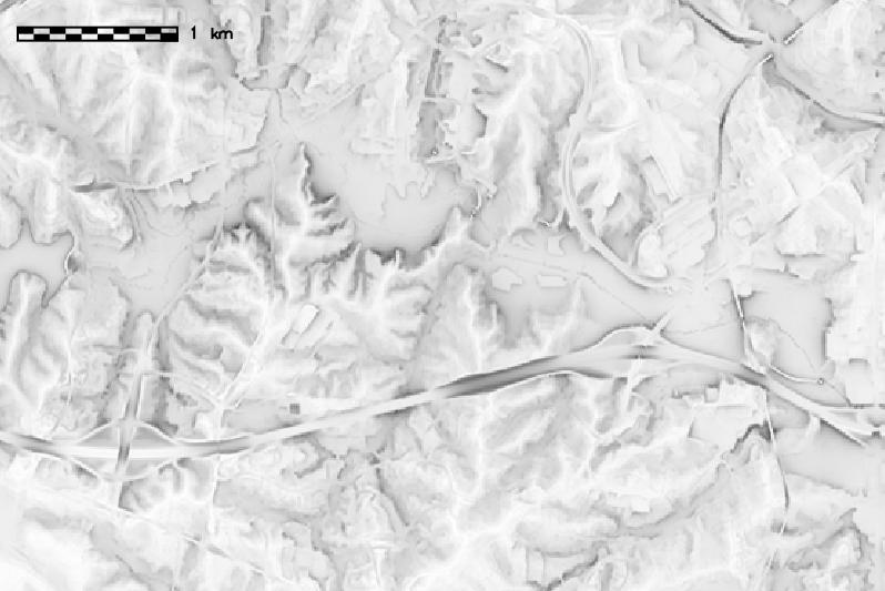
EXAMPLES
We compute the sky-view factor map of the North Carolina sample
dataset elevation map: