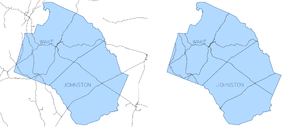
Figure: v.clip example - basic use
In default, boundaries of clip map are dissolved before clipping. Alternatively, flag -d can be ticked to retain the boundaries of clip map. Flag -b facilitates clipping by current computational region.
It is possible to clip vector maps consisting of points, lines, areas or combinations of these. However, the current version does not fully support clipping of mixed geometry containing points. In such a case, the output map will only store clipped lines and/or areas.
v.extract input=boundary_county where="NAME='WAKE' OR NAME='JOHNSTON'" output=county_WAKE_JOHNSTON
v.clip input=railroads clip=county_WAKE_JOHNSTON output=railroads_WAKE_JOHNSTON
v.clip -d input=railroads clip=county_WAKE_JOHNSTON output=railroads_WAKE_JOHNSTON
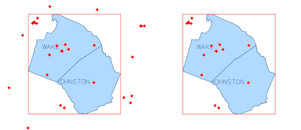
v.extract input=boundary_county where="NAME='WAKE' OR NAME='JOHNSTON'" output=county_WAKE_JOHNSTON
v.clip -r input=hospitals output=hospitals_clip
Last changed: $Date: 2016-06-28 19:30:00 +0001 (Tue, 28 Jun 2016)$