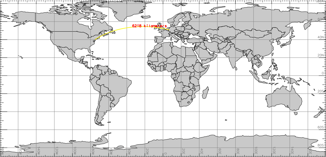
Visualization (with d.geodesic) of m.measure distance example
Bonn_DE="7.09549,50.73438"
Philadelphia_US="-75.16379,39.95233"

m.measure coordinates="$Bonn_DE,$Philadelphia_US" units=kilometers
Length:  6217.916452 kilometers
As an example for the North Carolina sample dataset, here four points describing a square of 1000m side length:
m.measure units=meters \
  coordinates=922000,2106000,923000,2106000,923000,2107000,922000,2107000
Length:  3000.000000 meters
Area:    1000000.000000 square meters

# script style output:
m.measure -g units=hectares \
  coordinates=922000,2106000,923000,2106000,923000,2107000,922000,2107000
units=meters,square meters
length=3000.000000
area=1000000.000000
Last changed: $Date$