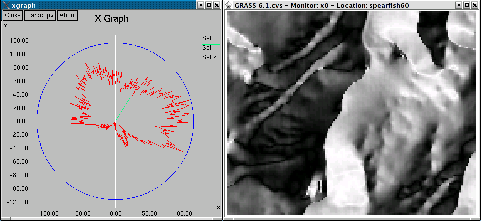
Polar diagram of aspect map
The radius of the outer circle is defined by the total number of pixels in the map. If the polar diagram does not reach the outer circle, no data (NULL) pixels were found in the map.
The vector in the diagram indicates a prevailing direction, its length the strength of such direction. In case all angle vectors are oriented along the same direction, the length for the vector is maximal (in fact it is equal to length of the most populated bin of the underlying histogram).
As a side effect, the quality of the angle map can be derived from the diagram. Strong spikes may indicate an over-representation of the related angle(s) which happens in particular if integer maps are used.
If d.polar is used on an aspect map generated by r.slope.aspect, the undef parameter should be set to 0 to distinguish NO DATA (NULL) areas from areas where aspect is undefined (i.e. flat areas).
d.polar aspect
Last changed: $Date$