DESCRIPTION
A rhumbline (loxodrome) is a line following a constant angle of the
compass (i.e., a line of constant direction). It crosses all meridians
at the same angle, i.e. a path of constant bearing.
d.rhumbline displays the
rhumbline joining any two user-specified points in the
active frame on the user's graphics monitor. The named
coordinate locations must fall within the boundaries of the
user's current geographic region.
The user has to specify the starting and ending
longitude/latitude coordinates of the rhumbline and
(optionally) the color in which the rhumbline will be
displayed; in this case, the program will run
non-interactively.
EXAMPLE
g.region vect=world_political -p
d.mon wx0
d.vect world_political type=area
d.rhumbline coor=55:58W,33:18S,26:43E,60:37N lcolor=yellow tcolor=red
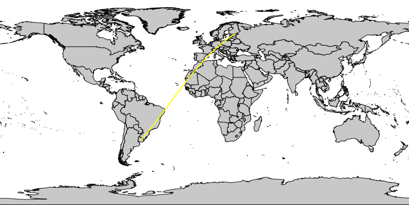
Rhumbline (loxodrome)
NOTES
This program works only with longitude-latitude locations.
SEE ALSO
d.geodesic
AUTHOR
Michael Shapiro,
U.S. Army Construction Engineering
Research Laboratory
Last changed: $Date$