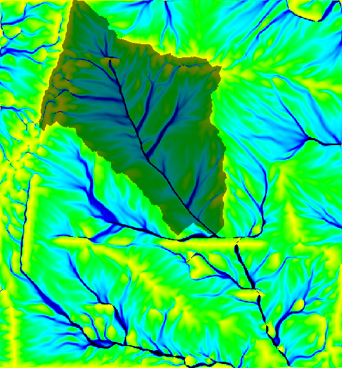
Figure: Watershed draped over flow accumulation
Input drainage direction map indicates the "aspect" for each cell. Multiplying positive values by 45 will give the direction in degrees that the surface runoff will travel from that cell. The value -1 indicates that the cell is a depression area. Other negative values indicate that surface runoff is leaving the boundaries of the current geographic region. The absolute value of these negative cells indicates the direction of flow. This raster map is generated from r.watershed.
Output raster map values of one (1) indicate the watershed basin. Values of zero (0) are not in the watershed basin.
g.region rast=elev_lid792_1m -p
# the watershed outlet position should be placed on a stream (from
# accumulation map):
r.watershed elev_lid792_1m thresh=5000 accum=accum_5K drain=draindir_5K basin=basin_5K
r.water.outlet input=draindir_5K output=basin_A30 coord=638740.423248,220271.519225

d.mon wx0
d.rast map=accum_5K
d.rast map=basin_A30

# overlay with transparency
r.colors map=basin_A30 color=grey
d.his h=accum_5K i=basin_A30
Last changed: $Date$