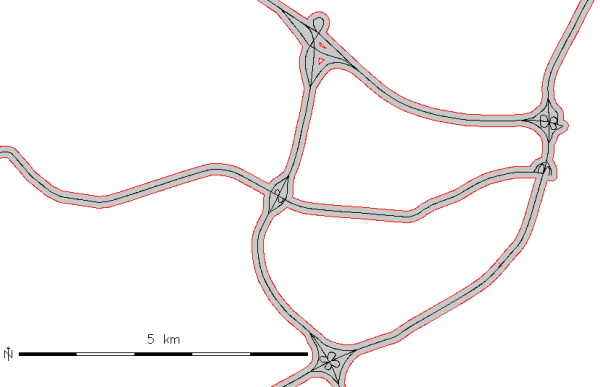
Buffer of 100m along the "roadsmajor" lines (map subset, original center line shown in black)
Categories and attributes can be transferred with the t flag. The resulting buffer areas can have multiple categories, and multiple buffer areas can have the same category. The buffer for the input feature with category X can thus be retrieved by selecting all buffer areas with category X (see example below).
Buffers for lines and areas are generated using algorithm from GEOS library. If GRASS is not compiled with GEOS support or environmental variable GRASS_VECTOR_BUFFER is defined, then GRASS generates buffers using built-in buffering algorithm (which is still buggy for some input data).
v.buffer input=roadsmajor output=roadsmajor_buffer type=line distance=100
v.buffer input=hospitals output=hospitals_circled type=point distance=2000
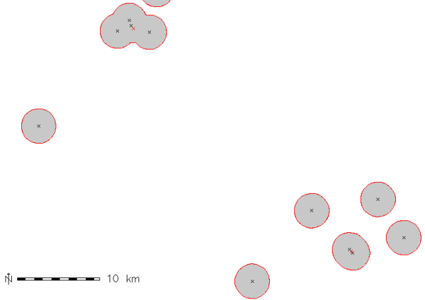
v.buffer input=hospitals output=hospitals_circled type=point distance=1000 -t

# display buffer around hospital with category 36,
# this buffer is composed of several areas:
d.vect map=hospitals_circled type=area layer=1 cats=36
# extract this buffer, dissolving boundaries
v.extract in=hospitals_circled output=hospital_36_circled layer=1 cats=36 -d
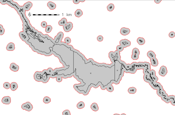
v.buffer input=lakes output=lakes_buffer type=area distance=100
Last changed: $Date$