What Is OSGeo?
Community Tools for a Creative City
Tyler Mitchell, Executive Director
Open Source Geospatial Foundation
My Background
- Geographer
- GIS Professional - Manager, User, R&D, Advocate
- Author, Web Mapping Illustrated (O'Reilly, 2005)
- Executive Director, Charter Member of OSGeo


What Is OSGeo?
- The leading voice for open source geospatial tools
- Non-profit legal entity
- Advocacy and promotion
- Developer support
- Draw together dev, user, implementor communities
- Build trust and proof case
The OSGeo Software Stack
- Data access libraries
- Data processing libraries
- Desktop GIS & image Analysis
- Web mapping frameworks
- Metadata catalogue
- Encouraging use of open standards
- Most built on OSS platforms
Community of Communities
- Draw together people
- Developers
- Users / Implementors
- Sponsors
- Draw together projects
- Projects come under umbrella
- 9 initial, 14 at present
- 4.8M LOC, 188 Contributors, 1,304 Years, $71M
- Diverse representation
- Active communities getting closer together
Remove Barriers
- Cross Geography & Language
- 6+ Local Chapters
- local/language organisation helping collaesce
- Cross Projects
- Refactoring / merging
- Stacks & binary builds
- Integration Demos
- Create New Projects
A Business Champion
- Promoting great projects without marketing budgets
- Lending a bigger, formal voice to community efforts
- Keeping FOSS on the radar
- Stabilising commercial future
- Increasing long-term public benefit
Opportunities
- Local and international events: FOSS4G2008.org
- Collaborating with others
- local conferences & workshops
- feedback and code contributions
- share your story and application
- Membership
- Sponsors


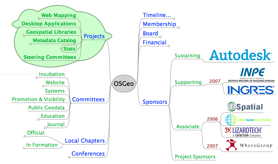
History / Overview Mindmap
History / Overview Mindmap
Closing Thoughts
- Mapping/geospatial tools already exist
- OSGeo tools help build professionals, not just users
- A vibrant community in your cities is waiting
Contact
Tyler Mitchell
- tmitchell@osgeo.org
- +1-250-277-1621
- http://www.osgeo.org
- http://wiki.osgeo.org