| FDO .NET API Reference | Feature Data Objects |
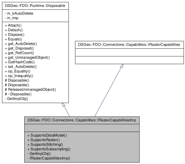
Inheritance diagram for OSGeo::FDO::Connections::Capabilities::IRasterCapabilitiesImp:

()
Definition at line 30 of file mgIRasterCapabilitiesImp.h.
Public Member Functions | |
| System::Boolean | SupportsDataModel (OSGeo::FDO::Raster::RasterDataModel *model) |
| Returns true if the provider can handle the provided data model. It is expected that when used to transform between data models, the matrix defined by input and output data models is not sparse for every data model that is supported. | |
| System::Boolean | SupportsRaster () |
| Returns true if the provider has raster capability. This implies the capability to define new raster properties on a class and store and retrieve raster images. | |
| System::Boolean | SupportsStitching () |
| Returns true if the provider has the capability to stitch images from a select command (query) together into a single image. | |
| System::Boolean | SupportsSubsampling () |
| Returns true if the provider can reduce the resolution of an image. | |
| Comments or suggestions? Send us feedback. |